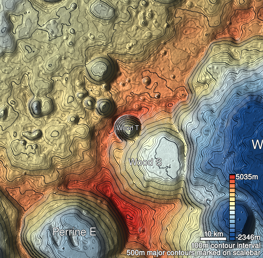
Pits Atlas: Wood T 1a
| Impact Melt pit: Wood T | |
|---|---|
| Name | Wood T 1a |
| Lat. | 43.8876 |
| Long. | 235.754 |
| Desc. | Roughly triangular pit, with a fan-shaped extension to the NE where the north half of the NE wall has collapsed (straight down, not into pit) to form a slope from surroundings to floor. Some potential tiny pits (~2m) ~10m NE of that extended section. Subtle depression to the E/NE (lowest point at edge of pit) that looks like the surroundings sagged a few meters. Possible visible west wall in slewed image (12 degrees), opposite wall from possible sag. ~150m W of Nameless A 1b. Region is a bit lumpy, but no depressions or fractures other than the two pits. |
| Types | |
| Terrain | Impact Melt |
| Host Feature | Wood T |
| Funnel Min. Diam. | 33 |
| Funnel Max. Diam. | 46 |
| Inner Min. Diam. | 25 |
| Inner Max. Diam. | 40 |
| Azimuth | 40 |
| Depth | 11.0 |
| Depth 1 | 11.1 |
| Depth 2 | 11.3 |
| Depth 3 | 10.5 |
| Best Stereo Left | M143078925L |
| Best Stereo Right | M143078925L |
| DTMs | |
| Clipping Width | 200 |
| Other IMGs | |
| Data Warning | M193783245R and M1158545901R are lit by crater wall-shine. |
| Entrance Ramp | Y |
| Overhang | N? |
| Nearby Pits? | Y |
| Nearby Fractures? | N |
| Nearby Depressions? | N |
| In Dome | Y |
| Beside Dome | Y |
| In Depression | N |
| Colinear Pits | N |
| Colinear Depressions | N |
| Colinear Fractures | N |
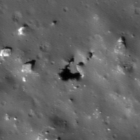
| Wood T 1a Shaded Relief | |
|---|---|
 |
| M1145626072L | |
|---|---|
 |
|
| Line | 25321 |
| Sample | 2695 |
| Inc. Angle | -53.16 |
| Emission Angle | 1.69 |
| Time | 14.41 |
| Resolution | 1.47 |
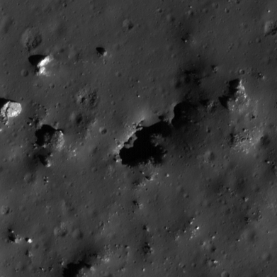
| M1114995520L | |
|---|---|
 |
|
| Inc. Angle | -52.01 |
| Emission Angle | 2.75 |
| Time | 14.27 |
| Resolution | 1.43 |
| M176082220L | |
|---|---|
 |
|
| Inc. Angle | 65.42 |
| Emission Angle | -0.42 |
| Time | 8.4 |
| Resolution | 0.48 |
| Wood T 1a Stereo |
|---|
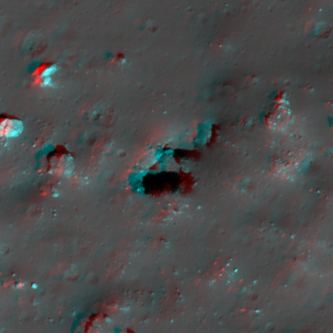 |