Pits Atlas: Aristarchus 2b
| Impact Melt pit: Aristarchus | |
|---|---|
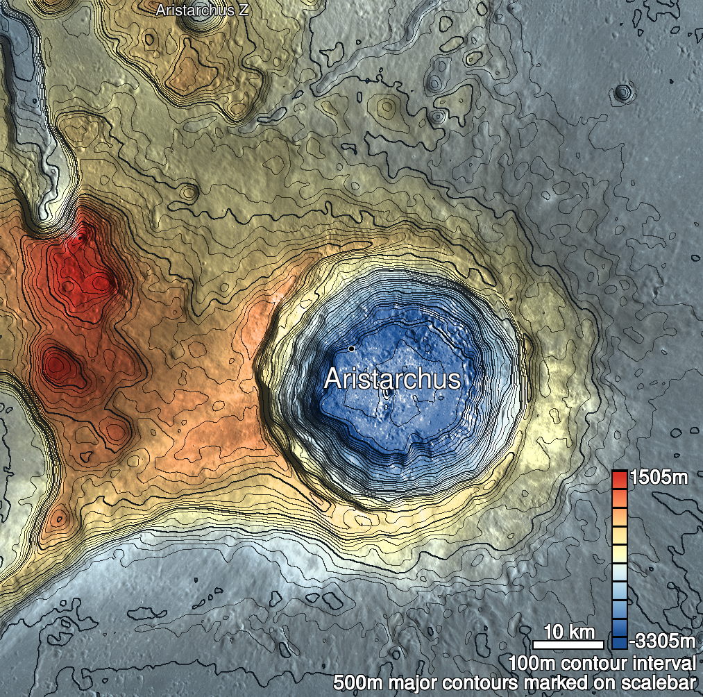
| Name | Aristarchus 2b |
| Lat. | 23.8726 |
| Long. | 312.3053 |
| Desc. | Central of a chain of three pits trending E-W. Complicated internal geometry: Sharp wall on three sides, NE wall slopes down to a sharp drop-off into an "inner pit". Also, there's a large boulder/projection on the SW wall. |
| Types | |
| Terrain | Impact Melt |
| Host Feature | Aristarchus |
| Funnel Min. Diam. | 13 |
| Funnel Max. Diam. | 22 |
| Inner Min. Diam. | 7 |
| Inner Max. Diam. | 13 |
| Azimuth | 165 |
| Depth | 14.0 |
| Depth 1 | 12.4 |
| Depth 2 | 16.3 |
| Depth 3 | N/A |
| Best Stereo Left | M1129801944L |
| Best Stereo Right | M1129801944L |
| DTMs | |
| Clipping Width | 200 |
| Other IMGs | |
| Data Warning | My shadow measurements are from the S and W walls to the floor of the inner pit. The NE wall to the inner floor is ~7 meters (from U1), and the depth from E rim to NE rim is <= 7.5 m (from U3) |
| Entrance Ramp | N |
| Overhang | ? |
| Nearby Pits? | Y |
| Nearby Fractures? | N |
| Nearby Depressions? | Y |
| In Dome | N |
| Beside Dome | N |
| In Depression | N |
| Colinear Pits | Y |
| Colinear Depressions | N |
| Colinear Fractures | N |
| Aristarchus 2b Shaded Relief | |
|---|---|
 |
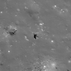
| M109548636R | |
|---|---|
 |
|
| Line | 4131 |
| Sample | 3104 |
| Inc. Angle | 25.79 |
| Emission Angle | 1.48 |
| Time | 11.69 |
| Resolution | 0.52 |
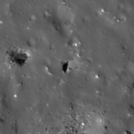
| M1193372314R | |
|---|---|
 |
|
| Inc. Angle | -27.32 |
| Emission Angle | 0.11 |
| Time | 12.75 |
| Resolution | 1.08 |
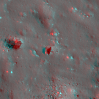
| M1129794833R | |
|---|---|
 |
|
| Inc. Angle | -46.82 |
| Emission Angle | -1.77 |
| Time | 14.7 |
| Resolution | 1.28 |
| Aristarchus 2b Stereo |
|---|
 |