Pits Atlas: Tycho 14
| Impact Melt pit: Tycho | |
|---|---|
| Name | Tycho 14 |
| Lat. | -43.1467 |
| Long. | 349.0718 |
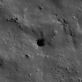
| Desc. | Round pit in a rather lumpy field. No floor visible, but a slewed near-noon image shows a probable boulder/wall protrusion that is not lit in other images. There's a ~60m wide linear depression/collapse ~250m S, running E-W, and some sort of broken/collapsed looking features ~150m N, but otherwise there's not much around. |
| Types | |
| Terrain | Impact Melt |
| Host Feature | Tycho |
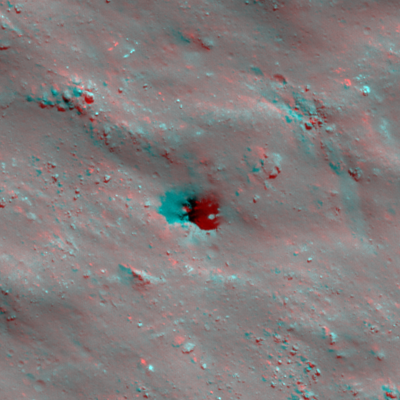
| Funnel Min. Diam. | 27 |
| Funnel Max. Diam. | 30 |
| Inner Min. Diam. | 10 |
| Inner Max. Diam. | 16 |
| Azimuth | 160 |
| Depth | >12.0 |
| Depth 1 | >12.0 |
| Depth 2 | >12.0 |
| Depth 3 | >7.0 |
| Best Stereo Left | M1210779685L |
| Best Stereo Right | M1210779685L |
| DTMs | |
| Clipping Width | 200 |
| Other IMGs | |
| Data Warning | |
| Entrance Ramp | N |
| Overhang | ? |
| Nearby Pits? | N |
| Nearby Fractures? | N |
| Nearby Depressions? | Y |
| In Dome | N |
| Beside Dome | N |
| In Depression | N |
| Colinear Pits | N |
| Colinear Depressions | N |
| Colinear Fractures | N |
| Tycho 14 Shaded Relief | |
|---|---|
 |
| M1144856403R | |
|---|---|
 |
|
| Line | 15906 |
| Sample | 1790 |
| Inc. Angle | -57.94 |
| Emission Angle | -0.74 |
| Time | 14.74 |
| Resolution | 0.62 |
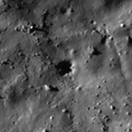
| M1151921968L | |
|---|---|
 |
|
| Inc. Angle | 57.98 |
| Emission Angle | -1.57 |
| Time | 9.13 |
| Resolution | 0.73 |
| M181236753R | |
|---|---|
 |
|
| Inc. Angle | -72.62 |
| Emission Angle | -2.26 |
| Time | 16.32 |
| Resolution | 1.01 |
| Tycho 14 Stereo |
|---|
 |