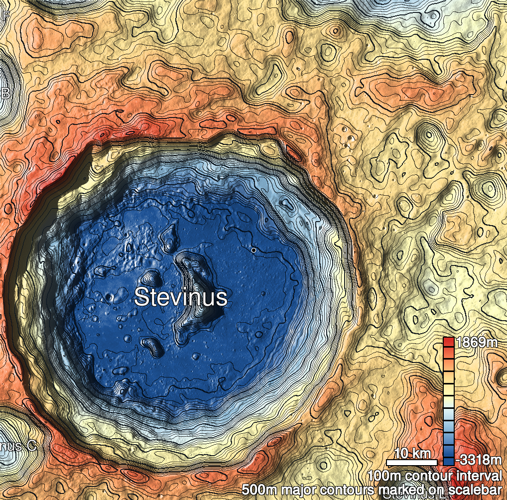
Pits Atlas: Stevinus 14a
| Impact Melt pit: Stevinus | |
|---|---|
| Name | Stevinus 14a |
| Lat. | -32.1634 |
| Long. | 54.7124 |
| Desc. | Irregular squarish pit, northern of a pair (Stevinus 14b is ~20m south). NW wall has a spur/shelf protruding in by about 7m, 3 meters below the rim. 45 degree slewed image cannot determine if there is any overhang, because the applicable region is in deep shadow due to the depth of the pit. There is a ~2m dark spot that might be either a pit or a cliff ~30m east. No other depressions in the area. |
| Types | |
| Terrain | Impact Melt |
| Host Feature | Stevinus |
| Funnel Min. Diam. | 16 |
| Funnel Max. Diam. | 20 |
| Inner Min. Diam. | 12 |
| Inner Max. Diam. | 14 |
| Azimuth | 115 |
| Depth | 14.0 |
| Depth 1 | 13.1 |
| Depth 2 | 13.8 |
| Depth 3 | 13.9 |
| Best Stereo Left | M1105574923R |
| Best Stereo Right | M1105574923R |
| DTMs | |
| Clipping Width | 200 |
| Other IMGs | |
| Data Warning | |
| Entrance Ramp | N |
| Overhang | ? |
| Nearby Pits? | Y |
| Nearby Fractures? | N |
| Nearby Depressions? | Y |
| In Dome | Y? |
| Beside Dome | N |
| In Depression | N |
| Colinear Pits | N |
| Colinear Depressions | N |
| Colinear Fractures | N |
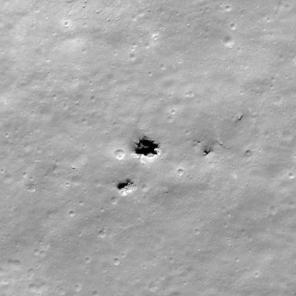
| Stevinus 14a Shaded Relief | |
|---|---|
 |
| M154873550L | |
|---|---|
 |
|
| Line | 51114 |
| Sample | 4352 |
| Inc. Angle | -34.86 |
| Emission Angle | 0.63 |
| Time | 12.63 |
| Resolution | 0.41 |
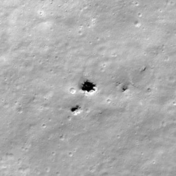
| M1116158959R | |
|---|---|
 |
|
| Inc. Angle | -37.32 |
| Emission Angle | -0.6 |
| Time | 13.13 |
| Resolution | 0.6 |
| M1164469403L | |
|---|---|
 |
|
| Inc. Angle | 31.36 |
| Emission Angle | -0.61 |
| Time | 11.77 |
| Resolution | 0.84 |
| Stevinus 14a Stereo |
|---|
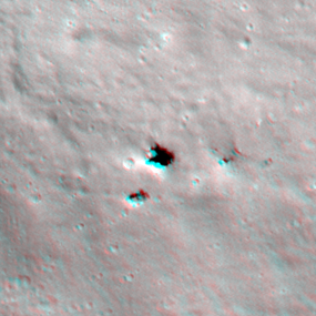 |