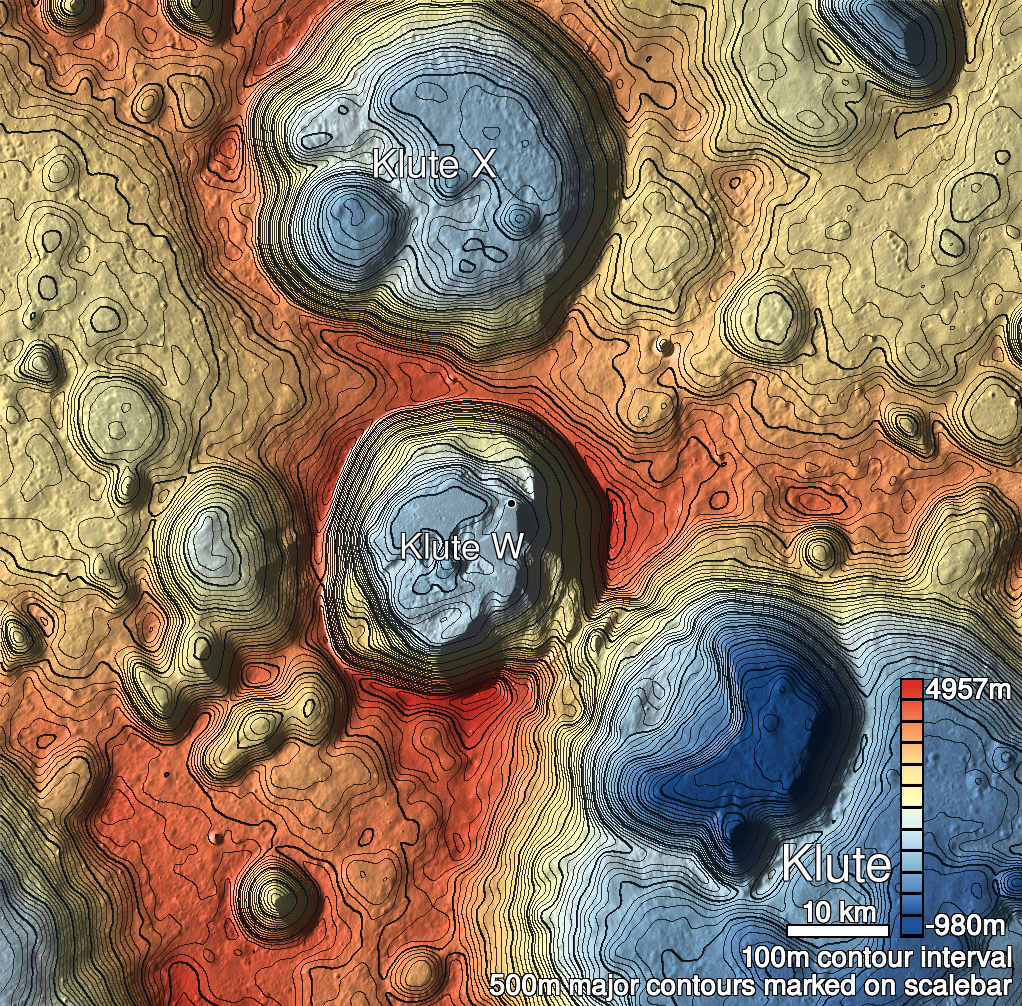
Pits Atlas: Klute W 6
| Impact Melt pit: Klute W | |
|---|---|
| Name | Klute W 6 |
| Lat. | 38.1256 |
| Long. | 216.901 |
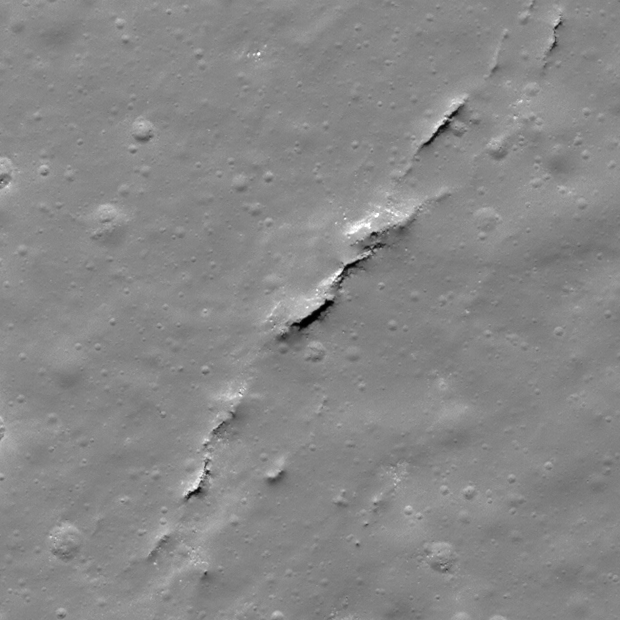
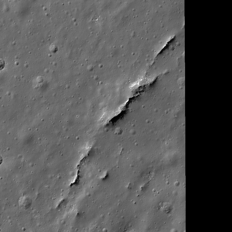
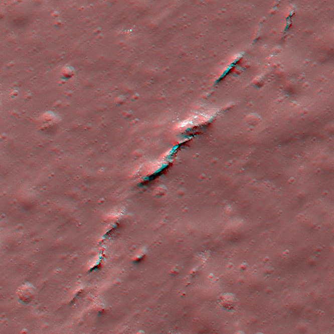
| Desc. | Rectangular pit in a series of NE-SW-trending fractures and depressions. The NW wall is a slope from rim to floor. There's a 22m long fracture 12m NE (arguably part of the same pit- the SE rim appears continuous, though more of a slight rise than a sharp rim in the space between pit and fracture). There's another NE-SW fracture ~120m NE of Klute W 6. Klute W 2 is ~300m SSW. |
| Types | |
| Terrain | Impact Melt |
| Host Feature | Klute W |
| Funnel Min. Diam. | 29 |
| Funnel Max. Diam. | 53 |
| Inner Min. Diam. | 12 |
| Inner Max. Diam. | 28 |
| Azimuth | 55 |
| Depth | 7.0 |
| Depth 1 | 7.0 |
| Depth 2 | 6.9 |
| Depth 3 | 6.2 |
| Best Stereo Left | M171495141L |
| Best Stereo Right | M171495141L |
| DTMs | |
| Clipping Width | 400 |
| Other IMGs | |
| Data Warning | |
| Entrance Ramp | Y |
| Overhang | ? |
| Nearby Pits? | Y |
| Nearby Fractures? | Y |
| Nearby Depressions? | Y |
| In Dome | N |
| Beside Dome | N |
| In Depression | Y? |
| Colinear Pits | Y |
| Colinear Depressions | N? |
| Colinear Fractures | Y |
| Klute W 6 Shaded Relief | |
|---|---|
 |
| M140840176R | |
|---|---|
 |
|
| Line | 11143 |
| Sample | 1874 |
| Inc. Angle | 39.89 |
| Emission Angle | 0.78 |
| Time | 11.67 |
| Resolution | 0.62 |
| M127871750L | |
|---|---|
 |
|
| Inc. Angle | 50.84 |
| Emission Angle | -3.01 |
| Time | 9.45 |
| Resolution | 0.47 |
| M1135119263R | |
|---|---|
 |
|
| Inc. Angle | 44.15 |
| Emission Angle | 1.15 |
| Time | 10.5 |
| Resolution | 1.59 |
| Klute W 6 Stereo |
|---|
 |