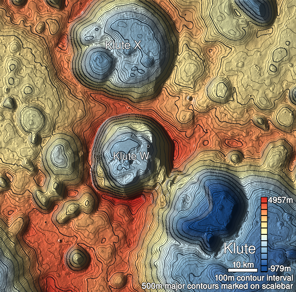
Pits Atlas: Klute W 3
| Impact Melt pit: Klute W | |
|---|---|
| Name | Klute W 3 |
| Lat. | 38.098 |
| Long. | 216.9385 |
| Desc. | Pit in the north side of a slight rise. North wall is a slope to floor level, other walls appear uncollapsed. ~200m NW of a NNE/SSW trending 50m-long fracture, and ~200m SE of Klute W 5. |
| Types | |
| Terrain | Impact Melt |
| Host Feature | Klute W |
| Funnel Min. Diam. | 19 |
| Funnel Max. Diam. | 20 |
| Inner Min. Diam. | 13 |
| Inner Max. Diam. | 18 |
| Azimuth | 145 |
| Depth | 6.0 |
| Depth 1 | 6.0 |
| Depth 2 | 4.7 |
| Depth 3 | 6.7 |
| Best Stereo Left | M171495141L |
| Best Stereo Right | M171495141L |
| DTMs | |
| Clipping Width | 200 |
| Other IMGs | |
| Data Warning | |
| Entrance Ramp | Y |
| Overhang | ? |
| Nearby Pits? | Y |
| Nearby Fractures? | Y? |
| Nearby Depressions? | Y |
| In Dome | Y |
| Beside Dome | Y |
| In Depression | N |
| Colinear Pits | Y? |
| Colinear Depressions | N |
| Colinear Fractures | N |
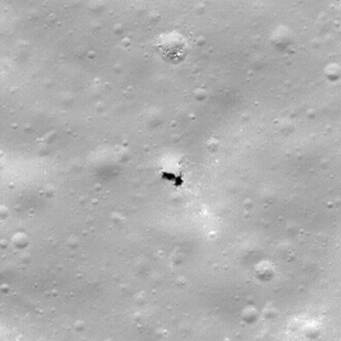
| Klute W 3 Shaded Relief | |
|---|---|
 |
| M140840176R | |
|---|---|
 |
|
| Line | 12390 |
| Sample | 425 |
| Inc. Angle | 39.86 |
| Emission Angle | -0.11 |
| Time | 11.67 |
| Resolution | 0.62 |
| M1115116170L | |
|---|---|
 |
|
| Inc. Angle | -47.01 |
| Emission Angle | 2.82 |
| Time | 14.15 |
| Resolution | 1.43 |
| M1119832662L | |
|---|---|
 |
|
| Inc. Angle | 42.95 |
| Emission Angle | -2.7 |
| Time | 10.46 |
| Resolution | 1.42 |
| Klute W 3 Stereo |
|---|
 |