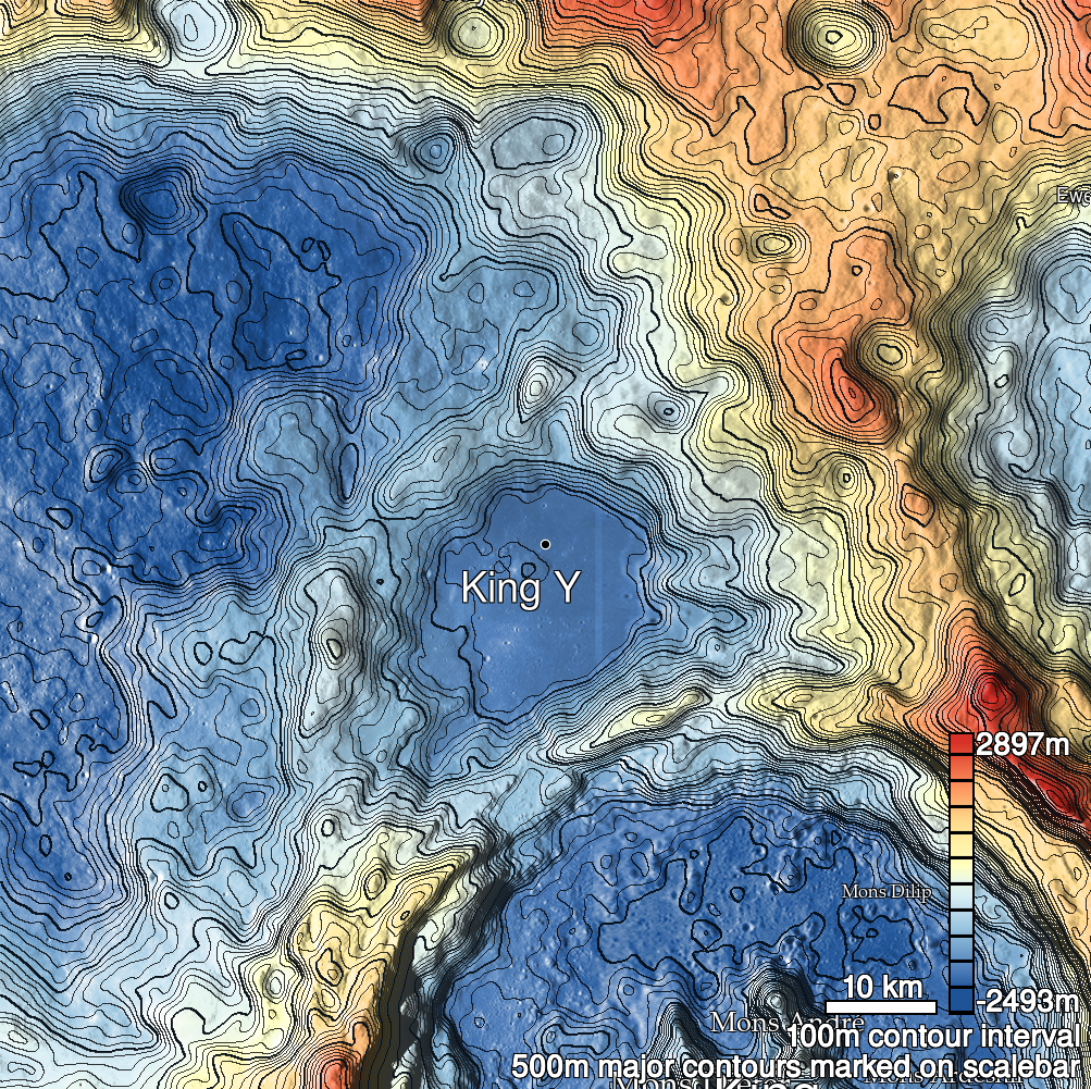
Pits Atlas: King 41
| Impact Melt pit: King | |
|---|---|
| Name | King 41 |
| Lat. | 6.6376 |
| Long. | 119.8299 |
| Desc. | Long, narrow pit ~60m S of a NW-SE trending linear depression containing a few fractures and collapses. SE rim is a ramp from surface to floor. NW end of floor is filled with 0.5-2m boulders. King 26 is ~300m W. |
| Types | |
| Terrain | Impact Melt |
| Host Feature | King |
| Funnel Min. Diam. | 7 |
| Funnel Max. Diam. | 16 |
| Inner Min. Diam. | 5 |
| Inner Max. Diam. | 12 |
| Azimuth | 135 |
| Depth | 6.0 |
| Depth 1 | 5.2 |
| Depth 2 | 3.5 |
| Depth 3 | 8.6 |
| Best Stereo Left | M136762839R |
| Best Stereo Right | M136762839R |
| DTMs | NAC_DTM_KINGCRATER3 |
| Clipping Width | 200 |
| Other IMGs | |
| Data Warning | Depth 3 is very high-Sun |
| Entrance Ramp | Y |
| Overhang | ? |
| Nearby Pits? | N? |
| Nearby Fractures? | N? |
| Nearby Depressions? | Y |
| In Dome | N |
| Beside Dome | N |
| In Depression | N |
| Colinear Pits | N |
| Colinear Depressions | N |
| Colinear Fractures | N |
| King 41 Shaded Relief | |
|---|---|
 |
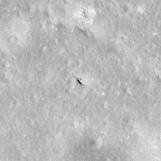
| M154453455R | |
|---|---|
 |
|
| Line | 27545 |
| Sample | 2958 |
| Inc. Angle | -16.17 |
| Emission Angle | -1.42 |
| Time | 13.03 |
| Resolution | 0.6 |
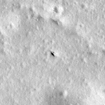
| M106088433R | |
|---|---|
 |
|
| Inc. Angle | -35.24 |
| Emission Angle | 0.21 |
| Time | 14.3 |
| Resolution | 1.29 |
| M108447638L | |
|---|---|
 |
|
| Inc. Angle | -11.13 |
| Emission Angle | 1.66 |
| Time | 12.51 |
| Resolution | 0.56 |
| King 41 Stereo |
|---|
 |