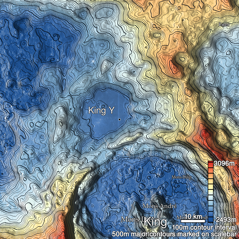
Pits Atlas: King 37
| Impact Melt pit: King | |
|---|---|
| Name | King 37 |
| Lat. | 6.3814 |
| Long. | 120.0056 |
| Desc. | Triangular pit, about half-way between two PRFs with edge collapses. Clean floor, possible slight overhang under W rim, although other images suggest that that wall slopes to nearly the floor. ~200m E of King 2. |
| Types | |
| Terrain | Impact Melt |
| Host Feature | King |
| Funnel Min. Diam. | 20 |
| Funnel Max. Diam. | 21 |
| Inner Min. Diam. | 9 |
| Inner Max. Diam. | 14 |
| Azimuth | 150 |
| Depth | 9.0 |
| Depth 1 | 7.9 |
| Depth 2 | 9.6 |
| Depth 3 | 9.6 |
| Best Stereo Left | M128509025L |
| Best Stereo Right | M128509025L |
| DTMs | NAC_DTM_KINGCRATER2 |
| Clipping Width | 200 |
| Other IMGs | M128509025L, M110804868L |
| Data Warning | |
| Entrance Ramp | N |
| Overhang | Y? |
| Nearby Pits? | Y |
| Nearby Fractures? | N |
| Nearby Depressions? | Y |
| In Dome | N |
| Beside Dome | N |
| In Depression | N |
| Colinear Pits | Y? |
| Colinear Depressions | N |
| Colinear Fractures | N |
| King 37 Shaded Relief | |
|---|---|
 |
| M1120456952R | |
|---|---|
 |
|
| Line | 27052 |
| Sample | 1947 |
| Inc. Angle | 32.22 |
| Emission Angle | 0.85 |
| Time | 9.88 |
| Resolution | 1.17 |
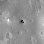
| M1131053889R | |
|---|---|
 |
|
| Inc. Angle | -27.63 |
| Emission Angle | -0.25 |
| Time | 13.77 |
| Resolution | 1.17 |
| M106088433R | |
|---|---|
 |
|
| Inc. Angle | -35.37 |
| Emission Angle | -2.33 |
| Time | 14.31 |
| Resolution | 1.29 |
| King 37 Stereo |
|---|
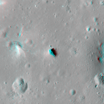 |