Pits Atlas: King 32
| Impact Melt pit: King | |
|---|---|
| Name | King 32 |
| Lat. | 6.3231 |
| Long. | 119.8067 |
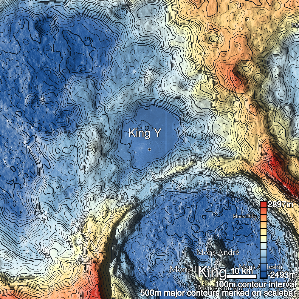
| Desc. | Round pit in a PRF in a group of NW-SE-trending fractures. One such fracture is in line with the pit, but stops ~150m SE at the edge of a nearby PRF. The N (uphill) rim is a slope from rim to floor. |
| Types | |
| Terrain | Impact Melt |
| Host Feature | King |
| Funnel Min. Diam. | 16 |
| Funnel Max. Diam. | 20 |
| Inner Min. Diam. | 11 |
| Inner Max. Diam. | 12 |
| Azimuth | 120 |
| Depth | 6.0 |
| Depth 1 | 6.0 |
| Depth 2 | 6.2 |
| Depth 3 | 6.3 |
| Best Stereo Left | M136762839L |
| Best Stereo Right | M136762839L |
| DTMs | NAC_DTM_KINGCRATER3 |
| Clipping Width | 200 |
| Other IMGs | |
| Data Warning | |
| Entrance Ramp | Y |
| Overhang | ? |
| Nearby Pits? | N? |
| Nearby Fractures? | Y |
| Nearby Depressions? | Y |
| In Dome | Y |
| Beside Dome | N |
| In Depression | N |
| Colinear Pits | N |
| Colinear Depressions | Y |
| Colinear Fractures | Y |
| King 32 Shaded Relief | |
|---|---|
 |
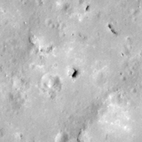
| M113168034L | |
|---|---|
 |
|
| Line | 30303 |
| Sample | 3877 |
| Inc. Angle | 47.42 |
| Emission Angle | -0.92 |
| Time | 8.87 |
| Resolution | 0.62 |
| M106088433L | |
|---|---|
 |
|
| Inc. Angle | -35.16 |
| Emission Angle | 0.53 |
| Time | 14.3 |
| Resolution | 1.29 |
| M1135766659R | |
|---|---|
 |
|
| Inc. Angle | 28.89 |
| Emission Angle | 0.1 |
| Time | 10.13 |
| Resolution | 1.17 |
| King 32 Stereo |
|---|
 |