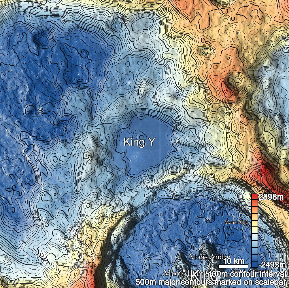
Pits Atlas: King 29
| Impact Melt pit: King | |
|---|---|
| Name | King 29 |
| Lat. | 6.4827 |
| Long. | 119.8145 |
| Desc. | Elliptical pit ~20m N of a ~100m wide PRF. There's a 20x2m fracture ~130m SW, oriented towards this pit, and some subtle, very straight linear depressions running NE-SW ~60m to the NW. |
| Types | |
| Terrain | Impact Melt |
| Host Feature | King |
| Funnel Min. Diam. | 15 |
| Funnel Max. Diam. | 18 |
| Inner Min. Diam. | 11 |
| Inner Max. Diam. | 14 |
| Azimuth | 155 |
| Depth | 6.0 |
| Depth 1 | 4.1 |
| Depth 2 | 6.4 |
| Depth 3 | 6.6 |
| Best Stereo Left | M103732241L |
| Best Stereo Right | M103732241L |
| DTMs | NAC_DTM_KINGCRATER3 |
| Clipping Width | 200 |
| Other IMGs | |
| Data Warning | |
| Entrance Ramp | N |
| Overhang | ? |
| Nearby Pits? | N? |
| Nearby Fractures? | N |
| Nearby Depressions? | Y |
| In Dome | N |
| Beside Dome | Y |
| In Depression | N |
| Colinear Pits | N |
| Colinear Depressions | N |
| Colinear Fractures | N |
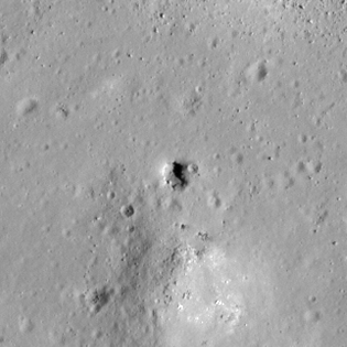
| King 29 Shaded Relief | |
|---|---|
 |
| M113168034L | |
|---|---|
 |
|
| Line | 22857 |
| Sample | 3485 |
| Inc. Angle | 47.43 |
| Emission Angle | -1.15 |
| Time | 8.87 |
| Resolution | 0.62 |
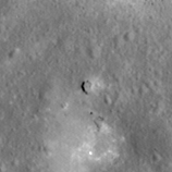
| M106088433L | |
|---|---|
 |
|
| Inc. Angle | -35.2 |
| Emission Angle | 0.42 |
| Time | 14.3 |
| Resolution | 1.29 |
| M185104801R | |
|---|---|
 |
|
| Inc. Angle | -20.88 |
| Emission Angle | -1.53 |
| Time | 13.36 |
| Resolution | 1.27 |
| King 29 Stereo |
|---|
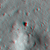 |