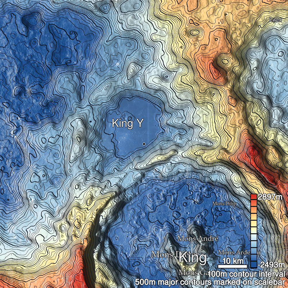
Pits Atlas: King 25
| Impact Melt pit: King | |
|---|---|
| Name | King 25 |
| Lat. | 6.2691 |
| Long. | 119.9429 |
| Desc. | Irregular pit between two branches of a fracture-and-pit system. Floor appears fairly smooth, although there's a downslope next to the W wall (or a boulder shadow- it's hard to tell at these resolutions). Fracture system is ~60m W, ~40m E, and ~120m S, and contains some interesting (and very deep) pits. |
| Types | |
| Terrain | Impact Melt |
| Host Feature | King |
| Funnel Min. Diam. | 12 |
| Funnel Max. Diam. | 15 |
| Inner Min. Diam. | 8 |
| Inner Max. Diam. | 12 |
| Azimuth | 145 |
| Depth | 7.0 |
| Depth 1 | 7.8 |
| Depth 2 | 7.1 |
| Depth 3 | 7.4 |
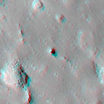
| Best Stereo Left | M128509025R |
| Best Stereo Right | M128509025R |
| DTMs | NAC_DTM_KINGCRATER2 |
| Clipping Width | 200 |
| Other IMGs | |
| Data Warning | |
| Entrance Ramp | N |
| Overhang | ? |
| Nearby Pits? | Y |
| Nearby Fractures? | Y |
| Nearby Depressions? | Y |
| In Dome | N |
| Beside Dome | N |
| In Depression | N |
| Colinear Pits | N |
| Colinear Depressions | N |
| Colinear Fractures | N |
| King 25 Shaded Relief | |
|---|---|
 |
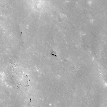
| M108447638R | |
|---|---|
 |
|
| Line | 36985 |
| Sample | 3815 |
| Inc. Angle | -10.95 |
| Emission Angle | -1.92 |
| Time | 12.52 |
| Resolution | 0.56 |
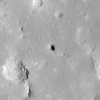
| M1131053889L | |
|---|---|
 |
|
| Inc. Angle | -27.54 |
| Emission Angle | 0.82 |
| Time | 13.76 |
| Resolution | 1.17 |
| M1120456952R | |
|---|---|
 |
|
| Inc. Angle | 32.26 |
| Emission Angle | 1.78 |
| Time | 9.88 |
| Resolution | 1.17 |
| King 25 Stereo |
|---|
 |