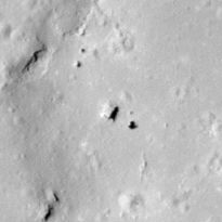
Pits Atlas: King 8a
| Impact Melt pit: King | |
|---|---|
| Name | King 8a |
| Lat. | 6.4369 |
| Long. | 119.8329 |
| Desc. | Square pit, largest of three pits and several other collapse features on a large PRF. King 8b is 15m SE, and King 86 is ~120m N. There is a pair of ~3-4m pits ~45m NW. There are several short (~30-40m) fractures/strings of tiny collapses in the area, both on and off the PRF. |
| Types | |
| Terrain | Impact Melt |
| Host Feature | King |
| Funnel Min. Diam. | 14 |
| Funnel Max. Diam. | 15 |
| Inner Min. Diam. | 10 |
| Inner Max. Diam. | 12 |
| Azimuth | 35 |
| Depth | 8.0 |
| Depth 1 | 9.0 |
| Depth 2 | 8.3 |
| Depth 3 | 7.4 |
| Best Stereo Left | M123791947R |
| Best Stereo Right | M123791947R |
| DTMs | NAC_DTM_KINGCRATER3 |
| Clipping Width | 200 |
| Other IMGs | |
| Data Warning | Depths 1 and 2 are from very high Sun |
| Entrance Ramp | N |
| Overhang | ? |
| Nearby Pits? | Y |
| Nearby Fractures? | Y |
| Nearby Depressions? | Y |
| In Dome | Y |
| Beside Dome | N |
| In Depression | N |
| Colinear Pits | N? |
| Colinear Depressions | N |
| Colinear Fractures | N |
| King 8a Shaded Relief | |
|---|---|
 |
| M141478563R | |
|---|---|
 |
|
| Line | 18595 |
| Sample | 1027 |
| Inc. Angle | 14.16 |
| Emission Angle | 0.28 |
| Time | 11.22 |
| Resolution | 0.61 |
| M154453455R | |
|---|---|
 |
|
| Inc. Angle | -16.12 |
| Emission Angle | -1.59 |
| Time | 13.03 |
| Resolution | 0.6 |
| M1135766659L | |
|---|---|
 |
|
| Inc. Angle | 28.89 |
| Emission Angle | -0.41 |
| Time | 10.13 |
| Resolution | 1.18 |
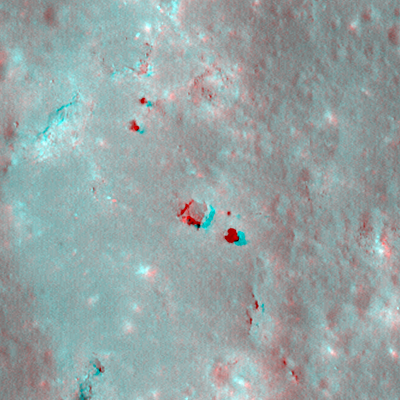
| King 8a Stereo |
|---|
 |