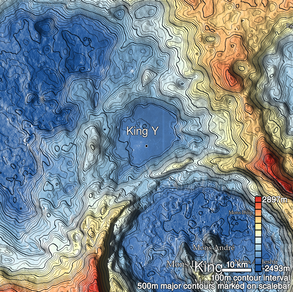
Pits Atlas: King 5
| Impact Melt pit: King | |
|---|---|
| Name | King 5 |
| Lat. | 6.3371 |
| Long. | 119.8005 |
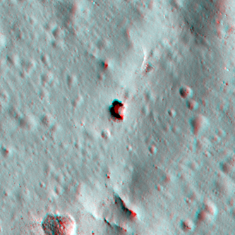
| Desc. | Semicircular pit in SW end of PRF. Does not appear to have any collapsed walls. No significant overhang to the east, no view to west. Floor is definitely lower than terrain around the PRF. There is a pair of fractures in a PRF ~70m S, at the north end of a string of subtle depressions running NNW-SSE |
| Types | |
| Terrain | Impact Melt |
| Host Feature | King |
| Funnel Min. Diam. | 20 |
| Funnel Max. Diam. | 23 |
| Inner Min. Diam. | 13 |
| Inner Max. Diam. | 16 |
| Azimuth | 180 |
| Depth | 7.0 |
| Depth 1 | 6.0 |
| Depth 2 | 9.6 |
| Depth 3 | 5.3 |
| Best Stereo Left | M136762839L |
| Best Stereo Right | M136762839L |
| DTMs | NAC_DTM_KINGCRATER3 |
| Clipping Width | 200 |
| Other IMGs | |
| Data Warning | Depth 1 is very high-Sun. |
| Entrance Ramp | N |
| Overhang | N? |
| Nearby Pits? | N |
| Nearby Fractures? | N? |
| Nearby Depressions? | Y |
| In Dome | Y |
| Beside Dome | Y |
| In Depression | N |
| Colinear Pits | N |
| Colinear Depressions | N |
| Colinear Fractures | N |
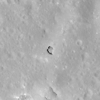
| King 5 Shaded Relief | |
|---|---|
 |
| M154453455R | |
|---|---|
 |
|
| Line | 12902 |
| Sample | 1675 |
| Inc. Angle | -16.06 |
| Emission Angle | -0.67 |
| Time | 13.02 |
| Resolution | 0.6 |
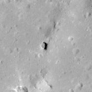
| M1181692437R | |
|---|---|
 |
|
| Inc. Angle | 32.35 |
| Emission Angle | 1.64 |
| Time | 9.88 |
| Resolution | 1.23 |
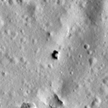
| M182745931L | |
|---|---|
 |
|
| Inc. Angle | -48.3 |
| Emission Angle | 1.59 |
| Time | 15.21 |
| Resolution | 1.27 |
| King 5 Stereo |
|---|
 |