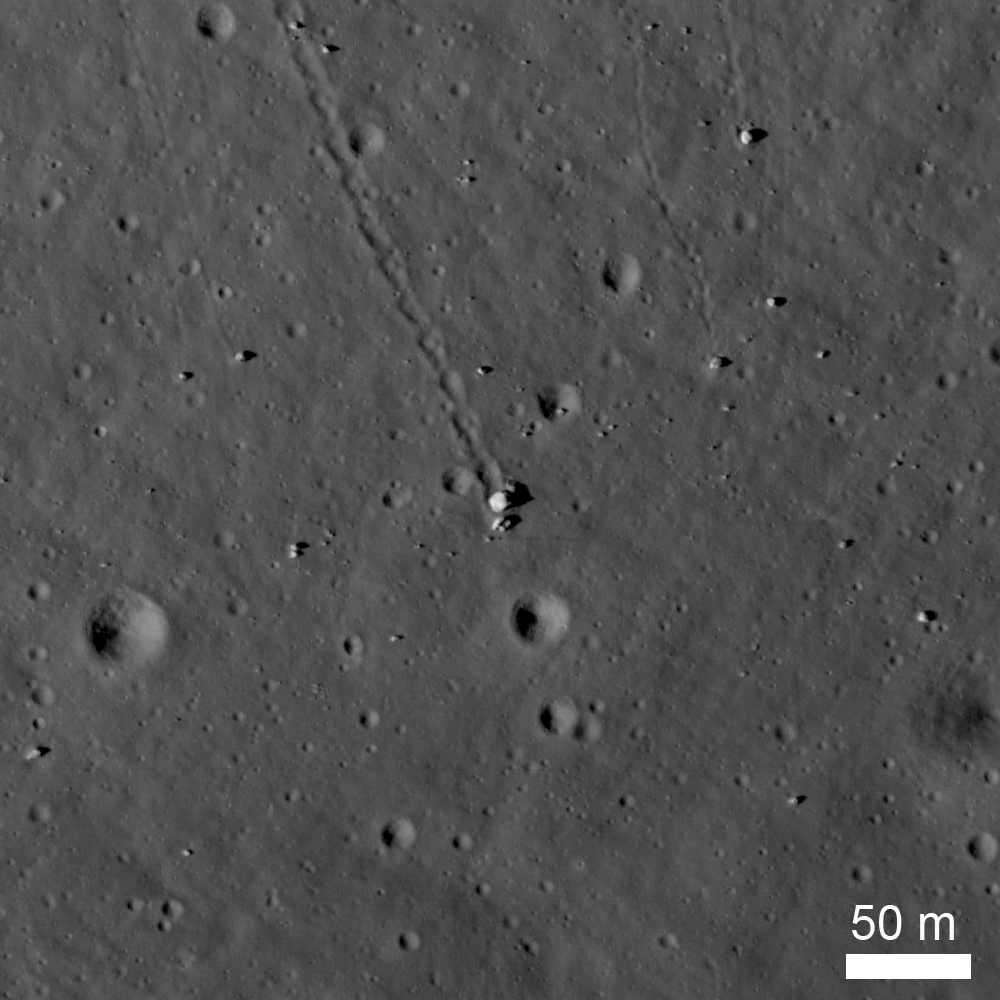
The North Massif lies along the northern side of the Taurus-Littrow Valley, the landing site of the Apollo 17 lunar module. Station 6 was visited during the third EVA (13 December 1972) and was intended as a location to collect ancient highland material from the North Massif as well as a dark mantle that locally covers the region. The sampling station is about 100 meters above the valley floor (elevation of -2560 meters). The North Massif rises some 1400 meters (4600 feet) above Station 6, and was likely formed in a few seconds as the result of the massive impact that created the Serenitatis Basin. One of the key science goals at Station 6 was to collect impact melt caused by that event. When rock is melted its radiometric clock is reset to time zero, so a sample of impact melt can be age-dated to determine when the basin formed.
At Station 6, five large blocks are clustered together on a surface that slopes toward the valley floor at about 16°. They lie at the end of a 980 m long boulder trail that formed as a single large boulder rolled down the hill. The trail is about 10-12 m wide with a scalloped edge and periodic small transverse ridges. This irregular pattern is the result of the irregular shape of the boulder. The original boulder was probably about 18 x 10 x 6 m. The largest fragment (Block #2) is about 10 m across.
It appears that the rolling ceased when the boulder broke apart and came to the rest in its present location. As the boulder rolled down the hill slope, it pushed up material along the edge of the track forming a berm. A small berm is also visible in front of the largest fragment. An expanded view of the boulders from an LROC image is shown below. Subtle brightness differences are apparent in the largest boulder in the center, and correspond to different rock types (the boulder is a breccia).

Pictures taken during the Apollo 17 EVA at Station 6 illustrate the relative size of the boulders; below Jack Schmitt is seen after after sampling the boulders.

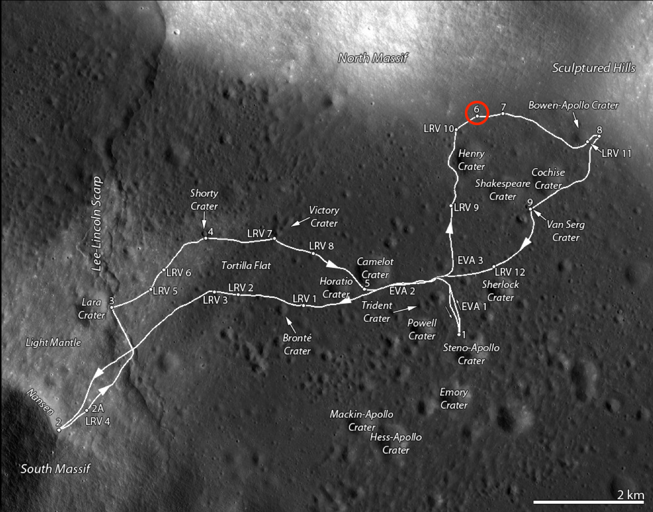
A number of samples were collected at Station 6. The illustration below shows the boulder group and a map made during the mission. The map indicates the location of the rock and soil samples as well as the location of the panoramic images.

Samples from the station include a single drive tube, ten rock samples (3 from the surface, four from block 1, one each from blocks 2, 4, and 5), several sediment samples (3 from between major blocks, one down slope from the blocks, one from the boulder track, and another from on top of block 1), and one rake sample from the ejecta blanket of a small crater to the northwest of the blocks.
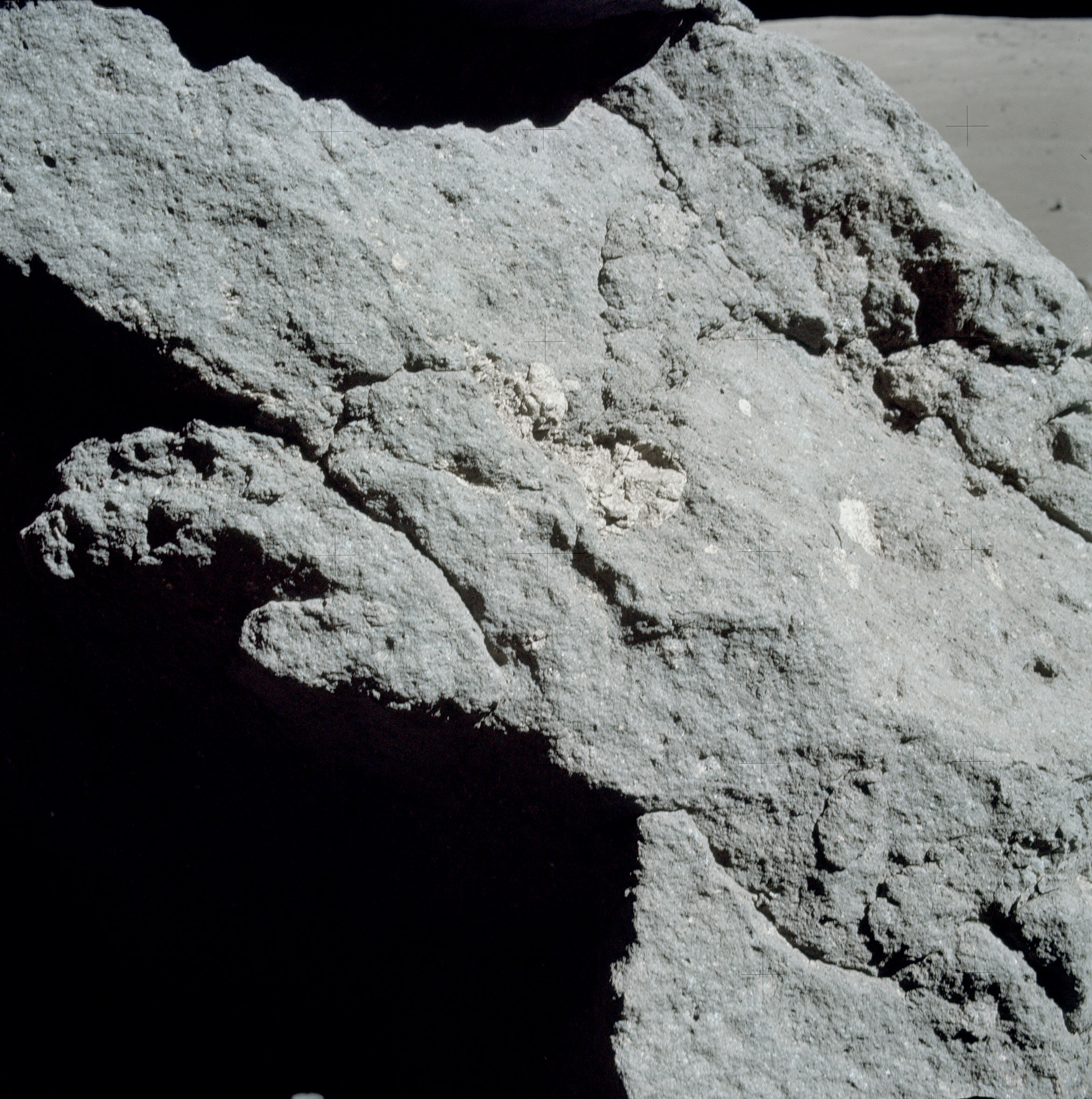
The boulders consist of clast-bearing impact melts. Despite the color differences, foliation and frequency of vesicles, the boulders consist of a chemically uniform matrix with clasts ranging in size up to about 1 meter in diameter. The clasts consists of rocks across the anorthosite-norite-troctolite suite or their impact-modified derivatives. Simonds (1975) suggested that the matrix is a clast-bearing rock formed by the mechanical mixture of cold, generally little-shocked clasts and superheated impact melt that rapidly quenched to form very-fine subophitic to ophitic crystalline groundmass. These samples have ages of around 3.98 Ga and are interpreted to represent the age of basin-forming event that produced the material, probably the Serenitatis Basin (as discussed in Ryder et al., 1997). However, more recent work suggests that the rocks collected at Station 6 may actually be ejecta from the Imbrium Basin forming event.
Explore the Taurus-Littrow Valley yourself!
Previous Apollo 17 Featured Images
Taurus Littrow Valley East-to-West
Approach To Taurus Littrow Valley
Published by Jeff Plescia on 13 December 2013