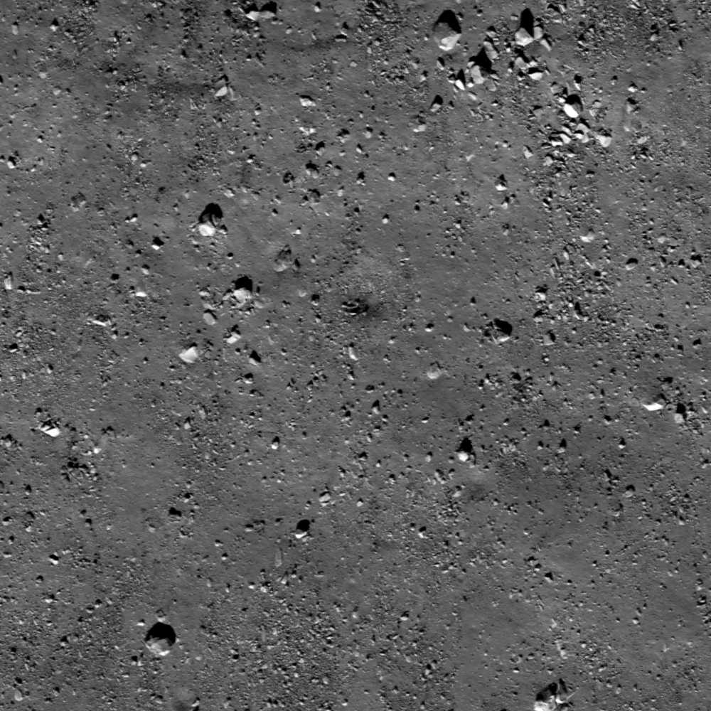
Featured Images occasionally highlight lunar boulders larger than a few meters. Observed on crater floors, near crater rims, and clustered atop wrinkle ridge crests, boulders provide excellent sampling opportunities for exploration (think: Station 6 Boulder samples from Apollo 17 helped scientists understand local and regional geology). However, like any terrestrial field location, context is crucial to developing a plan for fieldwork and sampling, and even though planetary scientists frequently rely on remotely sensed data, these scientists cannot test hypotheses unless they know where and what they are observing! So, looking at the image above, where is this boulder field located (crater floor? crater rim? wrinkle ridge? elsewhere?) and from where did these boulders originate?
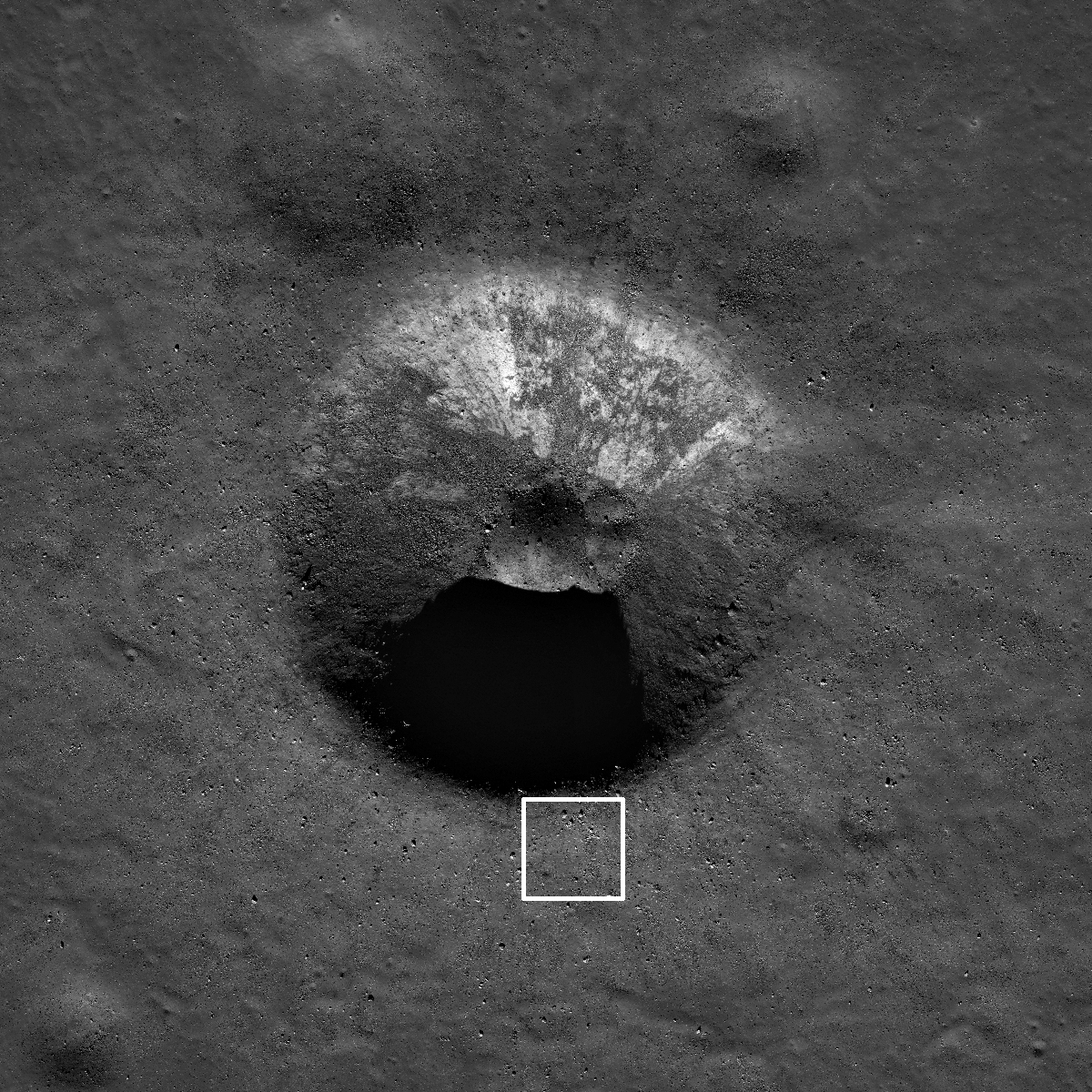
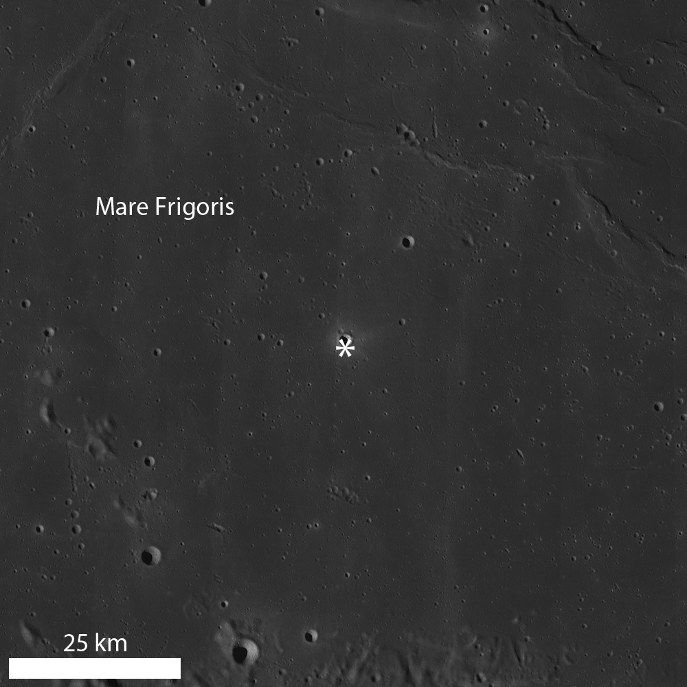
Taking a look at the zoomed out view in a reduced resolution NAC image, it becomes apparent that the opening image is located immediately exterior to the southern crater rim of an unnamed, 1.8 km diameter crater (located at 58.408°N, 351.859°E in Mare Frigoris). With this context, the location of the boulder field is revealed to be outside a mare crater. Furthermore, the origin of the boulder field is ejected material from the impact crater formation. Going back to the exploration thought - why would these boulders be advantageous to sample?
Sampling boulders close to the crater rim provides explorers the opportunity to collect rocks in a "radial traverse". The material right on the rim is mostly from deep within the crater and material further from the rim is from shallower within the crater. So as you approach a crater rim, the ejecta is progressively from deeper within the crater. This technique was employed by the Apollo 14 astronauts at Cone crater.
In the case of today's crater, the rocks sitting on the rim are from about 150 m below the surface even though the crater depth is about 360 m. During impact, part of the crater formation results from compression of the target and excavation flow (sideways movement of material), and for simple craters (<15 km diameter) an estimate of excavation depth is Hexc=0.1Dt, where Hexc is depth of excavation and Dt is transient crater diameter (diameter of the crater cavity at the conclusion of the excavation stage, before post-impact modification begins). The transient crater diameter can be estimated from the observed rim-to-rim diameter (what we measure today) using the relationship Dt=0.84D, where D is observed crater diameter. These relationships are explained in detail in Impact Cratering: A Geologic Process, by H. J. Melosh (1989).
Explore this 1.8 km impact crater in a virtual traverse using the full LROC NAC image!
Related Posts:
Sampling Schrödinger
Boulder trails in Menelaus crater
Physics is Fun!
Published by Lillian Ostrach on 30 January 2013