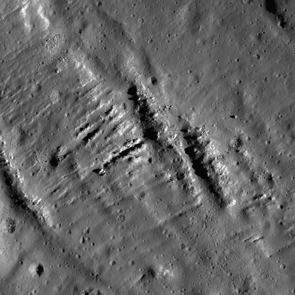
How did the complex terrain seen in this image form? The region is located on the lunar farside near King crater, a 77 km diameter impact crater characterized by several unusual features, including a large deposit of impact melt ponded in nearby Al-Tusi crater (see the WAC context image at the bottom of this post for the melt pond location). Elsewhere around the crater are vast areas that scientists hypothesize are coated with a veneer of impact melt. This material drapes the pre-impact terrain like a lumpy blanket -- varying in apparent thickness, ponding in small depressions here and there, and displaying fractures in many places.
Based on the geologic interpretation of landforms throughout the region, changes to this landscape from pre-impact to post-impact unfolded in a dramatic and complex sequence of events: the violent excavation of the King crater cavity was followed by the fall of ejecta, surging debris flows, large blocks of crust faulting and shifting in the crater walls, and super-heated impact melt flowing over the surface in sheets, rivulets, and cascades. It would have been an altogether disconcerting, but still very exciting, incident to behold first hand!

The wider-field WAC mosaic above gives a more comprehensive impression of the way this melt migrated across the surface before "freezing" (solidifying). With shadows giving a sense for topography, the more obviously fractured areas appear to occupy the higher ground of the region. The Featured Image is centered on an area of fractured melt where roughly one billion years of regolith development (perhaps 1 meter thick) from micrometeorite impacts has partially filled them, softening their appearance.

Compare the image above with its Digital Elevation Model counterpart below.

Explore the full NAC image below. Additional features in the King crater region can be found in the following Featured Image posts: Fault scarp with impact melt in King crater, Natural Bridge on the Moon!, and King crater ejecta deposits.
Published by James Ashley on 3 April 2012