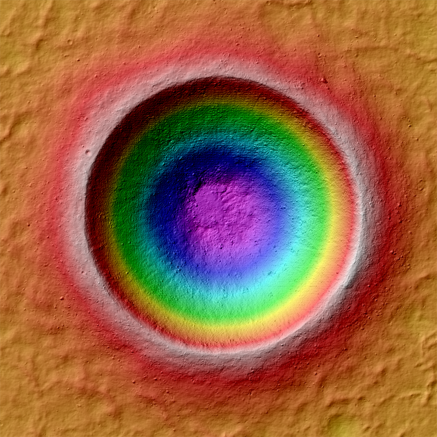
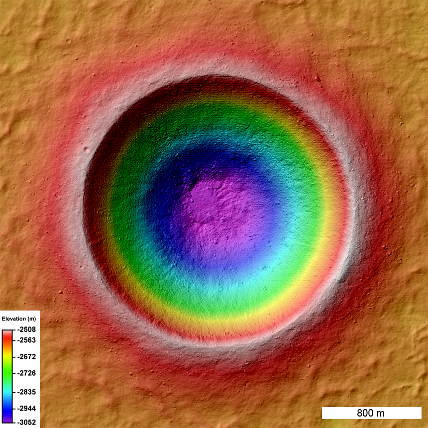
Linné (2.2 km diameter) is a very young and beautifully preserved impact crater. LROC stereo images provide scientists with the third dimension - information critical for unraveling the physics involved in impact events. The LROC science team presented a first analysis of Linné crater topology at the Lunar and Planetary Science Conference last week.
The high resolution topographic model also provides the means to make synthetic views of the crater from any angle. By creating hundreds of such views and slightly changing the view point for each image a dramatic fly around movie appears on the screen!
Today the LROC team released a set of NAC stereo derived map products. LROC NAC Digital Terrain Models (DTM) are made from geometric stereo pairs (two images of the same area on the ground, taken from different view angles under nearly the same illumination). LROC was not designed as a stereo system, but can obtain stereo pairs through images acquired from two orbits (with at least one off-nadir slew). Off-nadir rolls interfere with the data collection of the other instruments, so LROC slew opportunities are limited to four per day.
To a generate a DTM, we use a combination of the USGS Integrated Software for Imagers and Spectrometers (ISIS) and SOCET SET from BAE Systems. ISIS routines ingest the image files, perform a radiometric correction, and export to a format SOCET SET accepts. Next an analyst runs through several procedures, including detailed quality control, that take about a week to complete a DTM.
Once a DTM is complete we make derived products: orthorectified image, shaded-relief image, color shaded relief image, color slope map, and a confidence map. An orthorectified image has all topographical and camera distortions removed. These images are cartographically true and can be used to measure accurate distances. A shaded-relief generated using the DTM simulates the Moon's surface with a light source casting shadows on the terrain. Color coded elevations are draped on the shaded relief to form the color shaded relief map. Finally, slopes derived from the DTM are color coded to help users better discriminate subtle changes in elevation. A confidence map indicates the quality of the elevation estimate at each pixel. The standard PDS products include the DTM and orthorectified images in two resolutions (resolution of the DTM and resolution of the original images), and the confidence map. Also the shaded-relief, color shaded-relief, color slope map, and DTM are provided in GeoTIFF format. For more information on the methodology and preliminary error analysis of the DTMs, see Tran et al. 2010.
Explore the full resolution color shaded relief map and plan your own expedition to Linné crater.
Make sure and visit last Friday's Featured Image and watch the Moon rotate!
Published by Mark Robinson on 14 March 2011