Lunar Reconnaissance Orbiter Camera
  • Home
    • News & Announcements
    • Featured Images
    • Operations Journal
    • Targeting Tool
    • Ask a Question!
    • LRO Live! (videos)
    • Where is LRO?
    • Site Map
    • RSS Feed
  • What is LROC
    • What is LROC?
    • Mission Overview
    • LROC Summary
    • Objectives
    • Specifications
  • Images
  • Downloads
  • Outreach
    • Operations Journal
    • Ask a Question!
    • LRO Live! (videos)
    • Where is LRO?
    • Calendar
    • History
    • Explore the Moon
    • Educators
    • Students
    • Our Team
    • Press Kit
    • Press Archive
  • Tours
    • Tour Information
    • Arrange Tour
:: Homepage ::
:: "First LROC Stereo Results" by Mark Robinson « Featured Image « LROC News System ::

First LROC Stereo Results

LROC News System

Tuesday, August 25. 2009

25Aug

First LROC Stereo Results

Featured Image

Synthetic perspective view looking south from the Apollo 16 landing area, topography is rendered naturally (no vertical exaggeration) [NASA/GSFC/Ohio State University].


LROC has the ability to acquire stereo views by imaging a target from two separate orbits at different viewing angles. Typically stereo pairs are acquired from adjacent orbits to minimize changes in lighting conditions. Computer methods allow very accurate measurements of parallax between features of the two images, from which topographic maps are made. Such maps are termed digital elevation models, commonly called DEMs.

Perspective view, LROC image, and DEM [NASA/GSFC/Ohio State University].

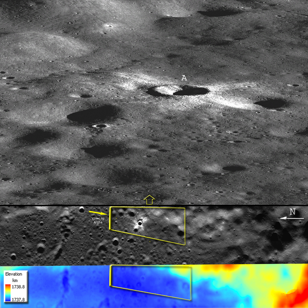
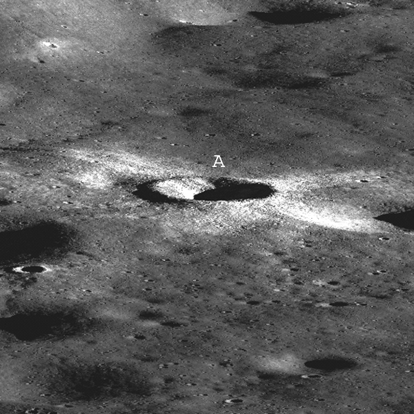
The area covered by this stereo pair shows the topography seen by the Apollo 16 astronauts, including rolling plains with many impact craters.  The 3-D DEM is colored showing elevations, ranging over about 1-kilometer. South Ray crater (A) in the perspective view is 750 meters in diameter and approximately 70 meters deep. The surrounding craters range from several meters in diameter to 1,200 meters. The tallest mountain in the southwest corner (lower right) of the DEM is 880 meters above the plain.

The DEM area [NAC images M102064759 and M102057602; centered at 9° S, 15.4° E] is 50 km long and 7 km wide. The LROC images were taken on July 12, 2009 during LRO orbit 218, near the Apollo 16 landing site. Images were processed using software developed by the Mapping and GIS Laboratory at the Ohio State University.     
Posted by Mark Robinson in Featured Image at 18:03
New System Links
  • News System Home «
  • Announcements «
  • Featured Image «
  • Operations Journal «
  • RSS Feed «

Quicksearch

Calendar

Back February '10 Forward
Mon Tue Wed Thu Fri Sat Sun
1 2 3 4 5 6 7
8 9 10 11 12 13 14
15 16 17 18 19 20 21
22 23 24 25 26 27 28

Categories

  • XML LROC
  • XML Announcements
  • XML Featured Image
  • XML Operations Journal


All categories
Goddard Space Flight Center Space Exploration Resources Adler Planetarium Arizona State University, School of Earth and Space Exploration
Comments and suggestions can be emailed to: lroc_webmaster@asu.edu